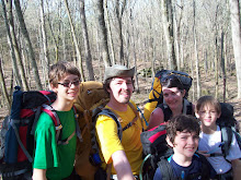
Sunrise over Moskey is breathtaking, and I'm quickly back in my bag for a short nap before our short day. Because we are only hiking about 6 miles, we sleep in, take a long pancake breakfast and break camp late. The hike today is mostly up as we head inland, none of it very steep, but up none the less. We run into a guy whose path we cross with throughout the trip, boat fiasco and all, he gives us a run down of the trail ahead and campsite we plan on staying at. We return the favor.

Lake Ritchie is very pretty but has a slight funk from an algae bloom the rangers warned us about. We lunch at lake Le Sage. A bit further than Isaac would have liked. All are pleased when shortly after lunch we cross over the Greenstone ridge and make it to camp at Chickenbone lake.

I'm continually amazed at how the character of the woods change around us. It seems that every trail we are on has it's own personality, and dominate feature/look. Today is the day of green as we head from Ritchie to the Greenstone. As we rise and fall over ridges we cross through swamps on plank bridges, in most of these giant skunk cabbage leaves have been broken over by the trampling of moose, and the ground is potted from their steps.

We end up at camp 6 which is one of the few lake side sites at West Chickenbone. Watch an OCD Red Squirrel gather nuts. Up the tree, stash the nut, down to a specific branch, jump to a small pine, stop, yell at us, down the tree, repeat. We have a nice dinner of mac-n-cheese followed by a fruit mix with grahams. Our new freezer bag cooking method is working well. The only failure was an oatmeal that refused to rehydrate. The lack of dishes to clean is awesome. The only other downfall is that it can be trying to eat from a quart bag.


I bust off for a day hike toward McCargo Cove while the boys whittle mallow sticks. I make it a good mile and a half when I decide to turn back. Hiking in the dark through the swampy areas around the lake do not sound appealing. Next time I'll remember to take my headlamp.

We finish the evening with mallows and watching an otter play and loon fish from across the lake. At dusk the boys spot a Snowshoe Hare at camp. I write in my journal while it is so quiet I hear only the dull thump of true silence.

Friday I awake to another beautiful sunrise. We are all up early as today is our long day, 12 miles down the Greenstone ridge. As we pack up camp thunderstorms start quickly rolling in. We make it back up to the Greenstone when they let loose. It rains almost continually from then until we set up our tents that night.


The walk is suppose to be our day of views, but the weather has other ideas. Visibility is at a max a hundred yards or so, but most of the time within 20-50 feet. Our ridge walk through the clouds is hauntingly beautiful. Glimpses of surrounding lakes and far ridges encourage our walk. Other than Ian we are in good spirits. He is having trouble dealing with the continual pound of the rain, not physical, he's as dry as can be and warm, just a general funk that threatens the morale of us all.

We hike on, Angie and I joke about having Lake Superior sloshing around in our boots. I joke at every northern lookout, "Hey boys, look, there's Canada". I set up the extra poncho I brought as for a little shelter just off the trail and we lunch. Lunch is a quick affair (tuna and lemon cous cous) as the longer we sit the more chilled we become. We have warmer clothing, but we are keeping it dry for when we get into camp. As long as we are moving we are all staying warm but the stops chill us quickly.

Lunch boosts morale, Ian has come to grips with the perpetual rain. The firetower is just a faded silhouette as we approach the summit of Mt. Ojibway. I can tell Angie is apprehensive as we climb as far as we can up the steel grated stairs. The view from just under the platform (the platform itself is closed) is 40 foot at best, but the we find it intriguing anyhow. The tower is now used for climate and air pollution monitoring.

Our original plan was to hike down the Greenstone ridge to Mount Franklin, then north to Lane Cove for the night. That would leave us with a 7 mile hike to get done before 2pm to catch our boat. We decided because of the rain, and the rough day today to hike south from Mt. Franklin to 3 mile and give ourselves an easy final hike in case the rain continues.

No comments:
Post a Comment